Department of Conservation and Recreation
Conserve. Protect. Enjoy.
Department of Conservation and Recreation


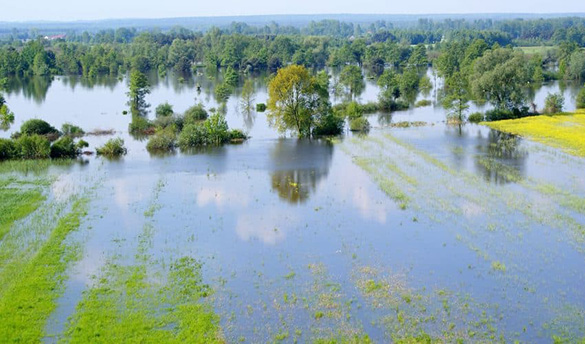
Floodplains serve a crucial natural function in managing floods by providing storage areas for excess water during times of high flow. Acting as natural sponges, floodplains absorb and temporarily hold floodwaters, reducing the speed and intensity of flooding downstream.
Additionally, well-managed floodplains facilitate the gradual release of stored water, replenishing groundwater supplies and supporting the health of surrounding ecosystems. By absorbing and redirecting floodwaters, floodplains help mitigate flood damage, protect communities, and maintain the balance of natural water systems.
Significant research has revealed the many beneficial roles natural floodplains play.
Floodplains support local economies and quality of life by:
Coastal Barrier Resource System (CBRS) areas are mapped by the U.S. Fish and Wildlife Service and include CBRS Units, Otherwise Protected Areas (OPAs) and Resource Protection Areas (RPAs).
CBRS Units - Relatively undeveloped lands, generally privately held, intended to follow geomorphic, development or cultural features.
OPAs - Generally consist of lands held by a qualified organization. The areas are primarily for wildlife refuge, sanctuary, recreational or natural resource conservation purposes.
RPAs - Corridors of environmentally sensitive lands that lie alongside or near the shorelines of streams, rivers and other waterways.
Coverage under the National Flood Insurance Program is not available for new or substantially improved structures in CBRS areas. Historically, these areas were shown on Flood Insurance Rate Maps, but CBRS areas were removed from these maps in February 2019. These areas are available on VFRIS. To view current boundaries and the official CBRS mapper, visit the U.S. Fish and Wildlife Service Coastal Barrier Resources Act page.
The Endangered Species Act establishes protections for fish, wildlife, and plants that are listed as threatened or endangered; provides for adding species to and removing them from the list of threatened and endangered species, and for preparing and implementing plans for their recovery; provides for interagency cooperation to avoid take of listed species and for issuing permits for otherwise prohibited activities; provides for cooperation with States, including authorization of financial assistance; and implements the provisions of the Convention on International Trade in Endangered Species of Wild Flora and Fauna (CITES).
Local floodplain administrators should reference FEMA’s Substantial Damage Quick Guide.
Local residents should reference Starting Your Recovery After a Flood, Returning Home After a Flood, and NFIP Rebuilding Safer & Stronger After a Flood.
For the latest information on Virginia’s response to Hurricane Helene, please visit the Virginia Department of Emergency Management’s website.
Contact Floodplain Management at FloodplainMgmt@dcr.virginia.gov